Beginner Backpack by the Sea, Point Reyes National Seashore, California
Sierra Club Outings Trip | Backpack

Highlights
- Learn about backpacking and marine life protection
- Explore a seascape of prairies, forests, and tide pools
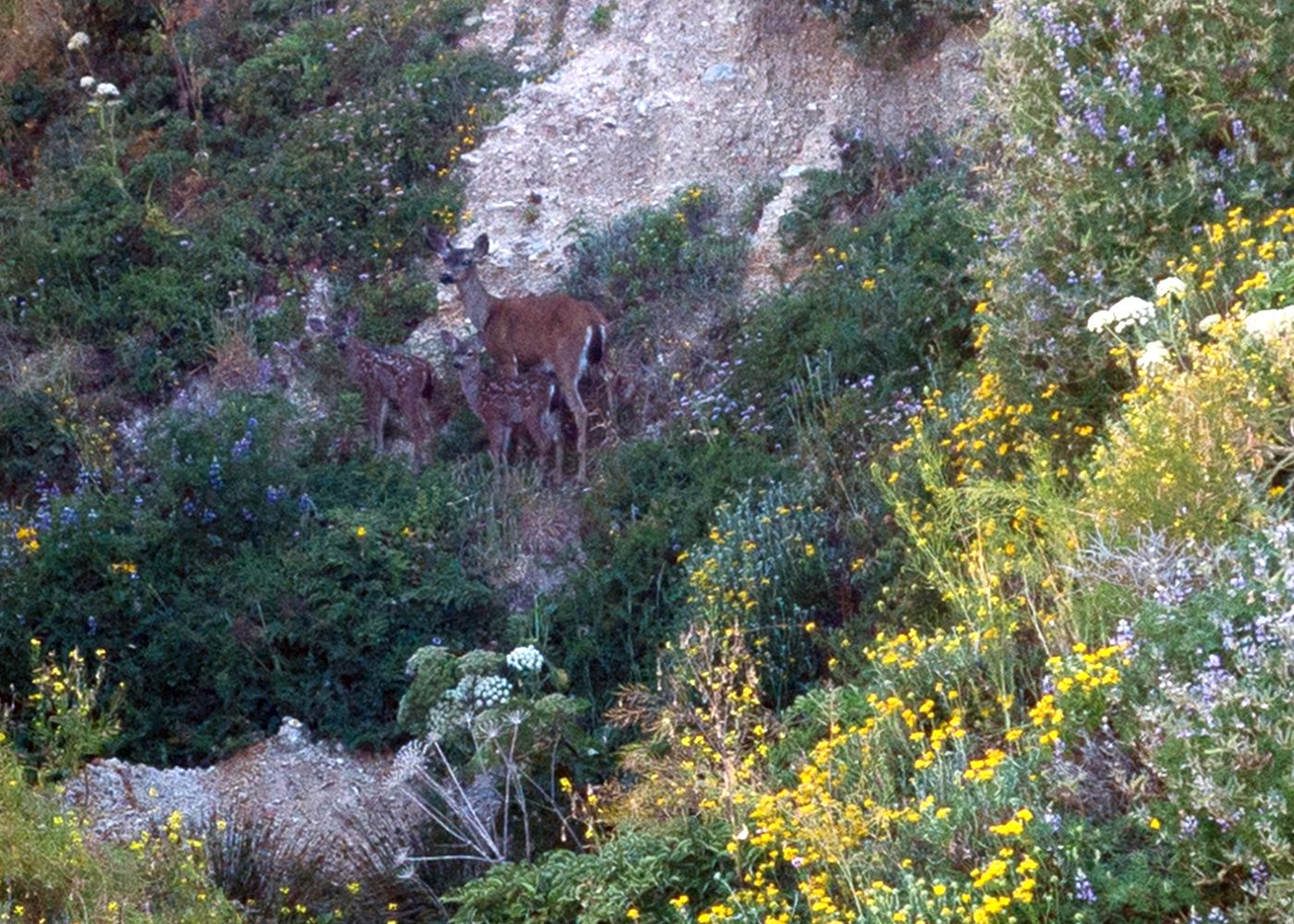
- Enjoy wildflowers, tule elk, seals, and much more
Includes
-
All campground fees, permits, and group cooking gear
-
Tasty vegetarian-friendly meals
-
Wilderness expertise and marine science education
Overview
The Trip
“I only went out for a walk, and finally concluded to stay out till sundown, for going out, I found was really going in.” - John Muir, 1900
Have you ever wanted to take a trip into the wilderness with a pack on your back, the camaraderie of new friends, great food, and a chance to explore one of California’s most picturesque coastlines? If so, this beginner’s backpacking trip to Pt. Reyes National Seashore is for you. Pt. Reyes offers the peaceful solitude of a protected wilderness about an hour away from the bustling city of San Francisco. It is the perfect place for beginners and experienced backpackers alike to learn or refresh backpacking skills. All hiking is on trail
The Trip
“I only went out for a walk, and finally concluded to stay out till sundown, for going out, I found was really going in.” - John Muir, 1900
Have you ever wanted to take a trip into the wilderness with a pack on your back, the camaraderie of new friends, great food, and a chance to explore one of California’s most picturesque coastlines? If so, this beginner’s backpacking trip to Pt. Reyes National Seashore is for you. Pt. Reyes offers the peaceful solitude of a protected wilderness about an hour away from the bustling city of San Francisco. It is the perfect place for beginners and experienced backpackers alike to learn or refresh backpacking skills. All hiking is on trail. Total trip distance is approximately 40 miles (21 miles backpacking plus roughly 20 miles day hiking). Leaders will provide a list of essential gear and offer training goals to help you prepare for the rigors of this beginner-friendly educational adventure.
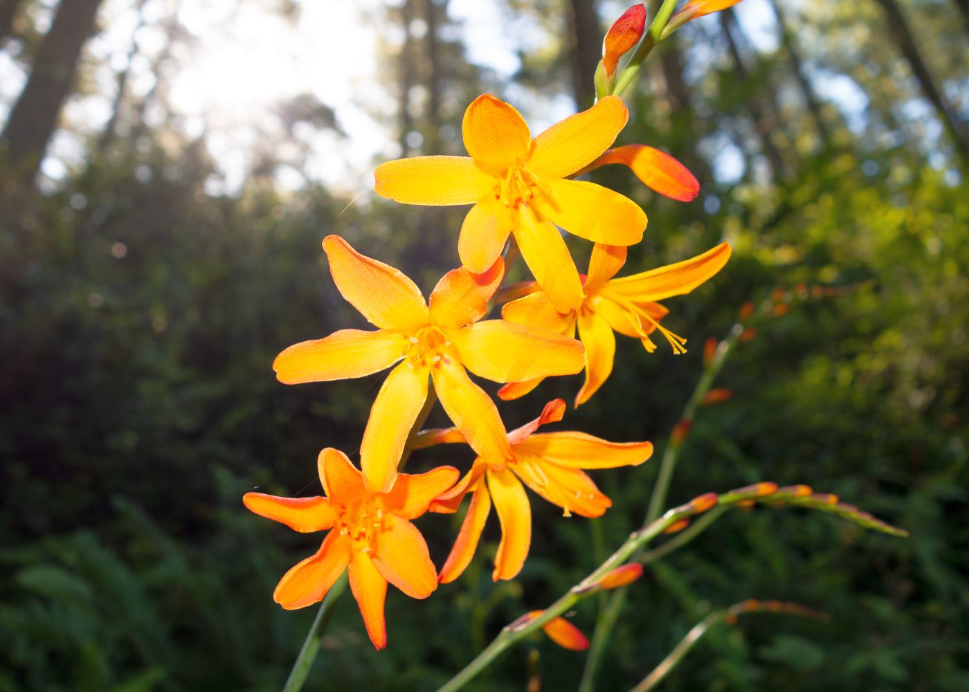
Our trip starts with day hikes on the first two days. We will carpool to trailheads to find wildflowers still in bloom. Trails lead us to spectacular overlooks and quiet beaches, and into a Tule elk reserve. We’ll search for outcrops of an ancient metamorphic rock known as gneiss. These are some of the oldest rocks in California. We’ll look for starfish in tide pools and learn why marine biologists call them “keystone species” that help maintain high levels of species diversity. We will look out across the water at the Farallon Islands and hear why white sharks aggregate in large numbers there. We’ll explore a replica village of the Coast Miwok and learn how these First People mastered fire and used it as a way to farm the land thousands of years before Europeans arrived with a different approach.
During our first two nights, we’ll pitch tents in a beautiful redwood forest campground before heading out for five days of remote backpacking through the National Seashore. Our route meanders through a stunning patchwork of wetland, prairie, forest, and beach habitats inhabited by a rich diversity of plants and animals all brought together by a fascinating geologic history.
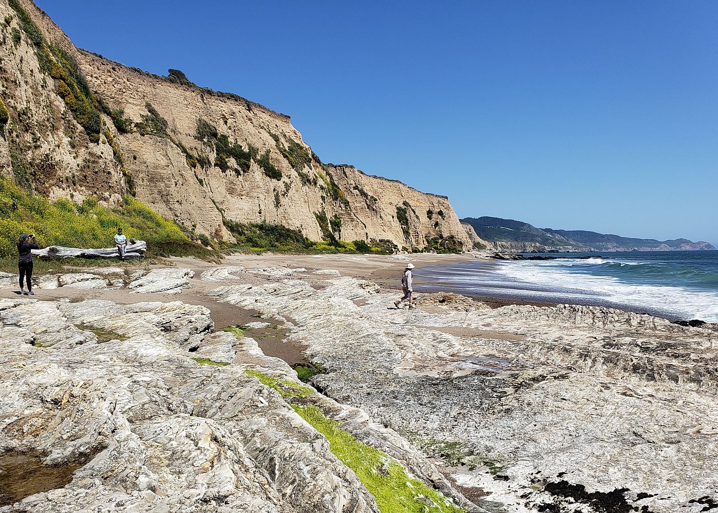
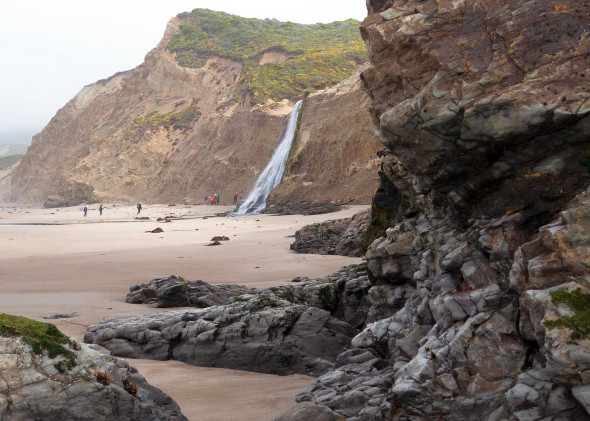
Our trip begins with a brief lesson in geology. Pt. Reyes is an island of granitic rock that originated, oddly enough, in the southern Sierra Nevada. Sometime during the Age of Dinosaurs this rock broke free and moved north along the San Andreas Fault. After tens of millions of years, it came to be just north of San Francisco. As we hike through this landscape of slowly shifting rock we will see scars, still visible, from the 1906 earthquake. We will hike down remnants of an Ice Age sand dune. Later we’ll hike to a waterfall spilling onto the beach and marvel at rocky cliffs twisted by tectonics along the way. We’ll travel through ranchland and learn how a compromise between farmers and environmentalists saved Pt. Reyes from logging and hotel development so the public can enjoy it free of charge today.
Join knowledgeable leaders with wilderness and marine science expertise as we explore, enjoy, and learn ways to protect this and other wild places with a pack on our back, boots on our feet, and adventure in our hearts.
Itinerary
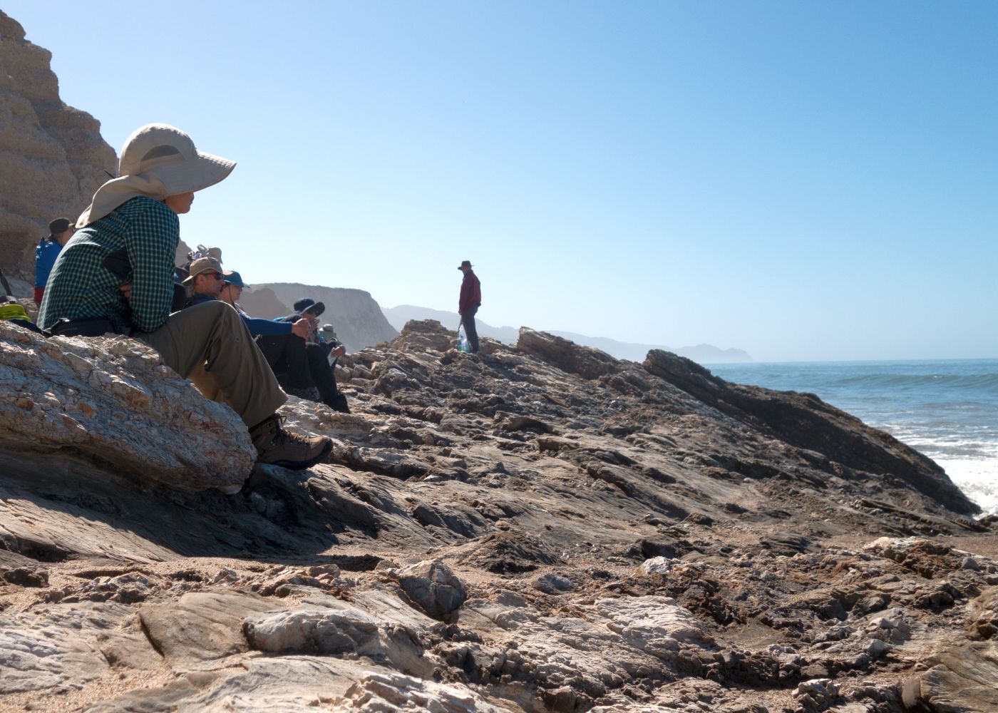
Day 1: We will meet in the morning at a pre-arranged location. After introductions and trip orientation, we’ll set off on short day hikes highlighting geology and a short history of the Coast Miwok, who were the first inhabitants of Pt. Reyes. Afterward, we will carpool to Chimney Rock trailhead. During this hike we will identify wildflowers and learn how to use a map and compass. Some may want to identify seabirds soaring over Chimney Rock. We hope to spot young elephant seals and harbor seals (can you tell the difference?) napping on the beaches of Drakes Bay. Trip leaders will provide a picnic lunch. By late afternoon we will drive to our campsite, set up tents, and make dinner. Total hiking distance: 5 miles. Elevation gain/loss: 300 feet
Day 1: We will meet in the morning at a pre-arranged location. After introductions and trip orientation, we’ll set off on short day hikes highlighting geology and a short history of the Coast Miwok, who were the first inhabitants of Pt. Reyes. Afterward, we will carpool to Chimney Rock trailhead. During this hike we will identify wildflowers and learn how to use a map and compass. Some may want to identify seabirds soaring over Chimney Rock. We hope to spot young elephant seals and harbor seals (can you tell the difference?) napping on the beaches of Drakes Bay. Trip leaders will provide a picnic lunch. By late afternoon we will drive to our campsite, set up tents, and make dinner. Total hiking distance: 5 miles. Elevation gain/loss: 300 feet.
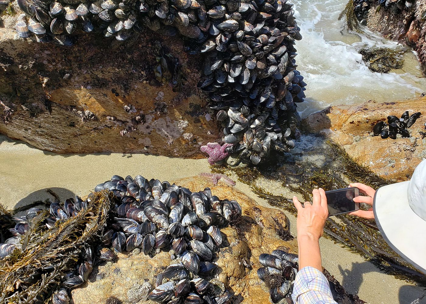
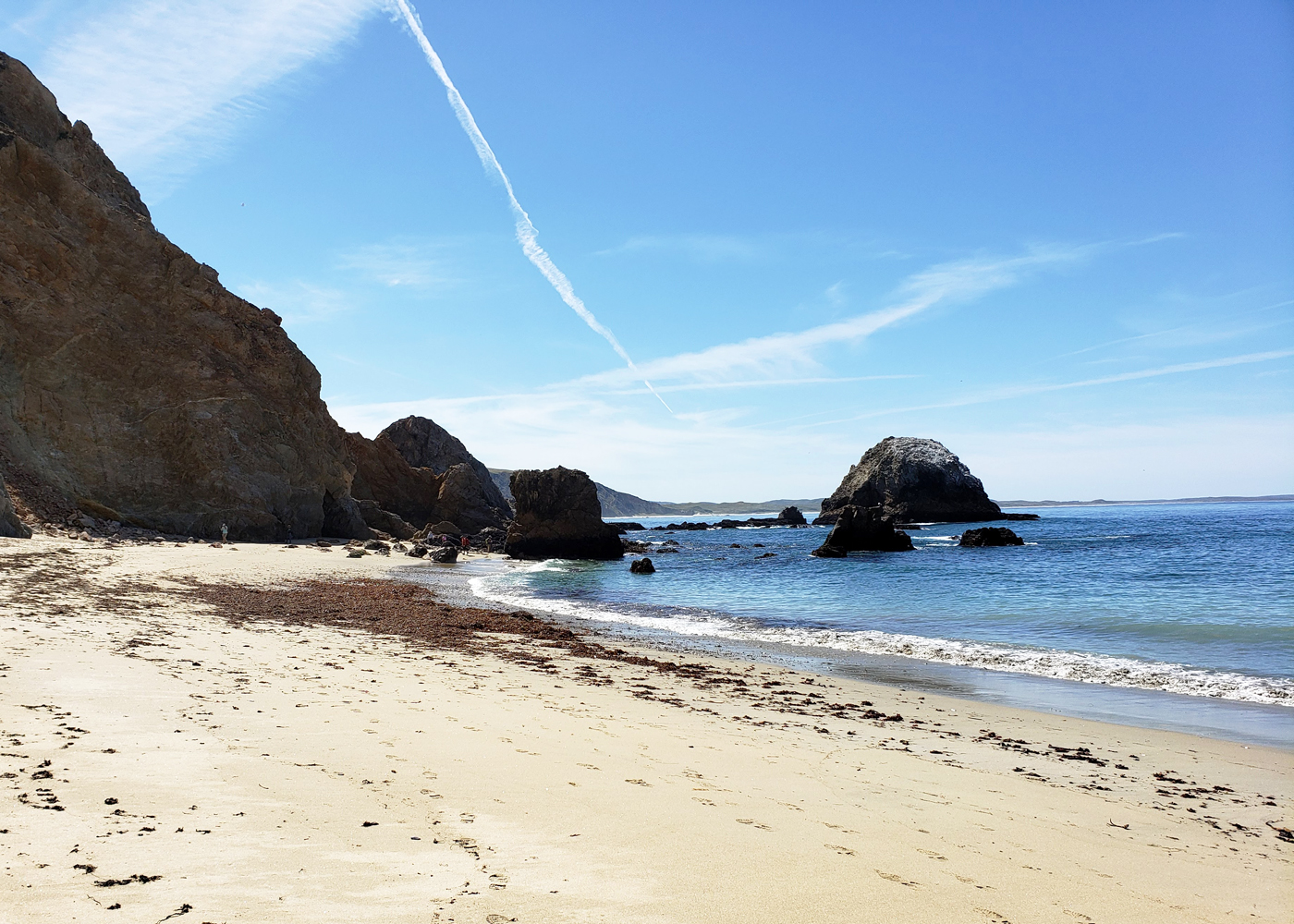
Day 2: After breakfast, we will carpool to McClures Beach where it will be low tide. Hidden among boulders of this photogenic cove are some of California’s oldest rocks (gneiss). These rocks were formed deep in the earth at great pressure. This caused the rock’s minerals to be stretched into artistic ribbon-like patterns now trapped in stone. We will take time to look for starfish in tide pools. In 2013, starfish disappeared from Pt. Reyes and much of the West Coast due to a wasting disease. The McClure Beach starfish population is one of a few populations now recovering from this devastating disease.
After lunch, we will follow a nearby trailhead to the Tule Elk Reserve. These magnificent animals once roamed in large herds across much of California. But in the 1800s, unregulated hunting and displacement by cattle caused their numbers to sharply decline. By 1870, the species was thought to be extinct. Fortunately, a few survived and in 1976, 10 animals were reintroduced to Pt. Reyes. Today, the herd has grown to over 400 creating new concerns for their management. By later afternoon we will drive back to camp for dinner and prepare for tomorrow’s first day of backpacking. Total hiking distance: 7-8 miles. Elevation gain/loss: 800 feet.
Day 3: After breakfast, we'll make final pack adjustments then head out on our first day of backpacking. Our trek requires us to climb 1,300 feet up Inverness Ridge. Some may want to take a side trip to the top of Mt. Wittenberg before we settle in at Sky Camp. In the evening, we'll enjoy panoramic views high above Drakes Bay. We might imagine what it was like, so long ago, high atop this ridge when Sir Frances Drake first rowed ashore in 1579 to claim the land in the name of England's queen. Or perhaps we might imagine a more desperate scene when a Spanish galleon, the San Agustin, was shipwrecked in this bay, leaving behind treasures for others to find. Total hiking distance: 3.1 miles. Elevation gain: 1,300 feet.
Day 4: Today, we’ll hike mostly downhill to our next campsite and arrive to set up tents by early afternoon. We should have plenty of time to have an afternoon walk along the beach, scan the horizon for migrating whales, and explore a tide pool before it is washed over by the evening tide. While on the beach we will collect trash to highlight a growing concern about plastics. Total hiking distance: 4.2 miles. Elevation gain: 200 feet; loss: 1,500 feet.
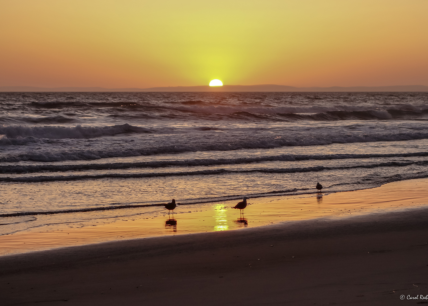
Day 5: This is going to be a long, but scenic day filled with plenty of opportunities for taking panoramic photos and spotting marine mammals, including whales. We’ll backpack above the cliffs to Wildcat Camp, ascending roughly 750 feet before dropping down to a beautiful meadow on a bluff overlooking the sea. Here, we’ll spend two nights. Total hiking distance: 8.5 miles. Elevation gain/loss: 850 feet.
Day 6: Layover day! Take a morning stroll along the beach to Alamere Falls and watch the water plummet over the cliff to the sea. Marvel at towering rock walls twisted by tectonic uplift where clusters of native plants cling precariously by their delicate roots and decorate the ancient stones. Explore sea caves and tide pools and hike to Bass Lake after lunch. Or simply relax on the beach.
After sunset, we might glimpse streaks of the Milky Way above the faint glow of San Francisco’s city lights on the southern horizon, reminding us that the modern world is not far away. Total hiking distance: 8 miles. Elevation gain/loss: 450 feet.
Day 7: Our final day takes us back up Inverness Ridge, through coastal chaparral and green forests, and into Divide Meadows, where we’ll enjoy lunch. Afterward, we’ll head back to Bear Valley, where we left our cars. With reluctant goodbyes, we’ll part company to take memories of our wilderness experience back home to share with family and friends. Total hiking distance: 6.3 miles. Elevation gain: 1,100 feet.
Logistics
Getting There
The trip begins on Sunday morning at the park's visitor center. After introductions and a short orientation, we'll begin the day's activities. We encourage you to spend the night before the trip locally so that you can meet us on time. Suggestions for lodging will be sent to participants once they are approved for the trip.
The nearest airports are San Francisco (SFO) and Oakland (OAK), each about 45 miles from our meeting place. The park is also accessible by public transportation. From San Rafael, the West Marin Stagecoach bus route (#68) goes directly to Pt. Reyes National Seashore visitor center. However, travel times are roughly 30-45 minutes longer by bus than by car, so plan accordingly
Getting There
The trip begins on Sunday morning at the park's visitor center. After introductions and a short orientation, we'll begin the day's activities. We encourage you to spend the night before the trip locally so that you can meet us on time. Suggestions for lodging will be sent to participants once they are approved for the trip.
The nearest airports are San Francisco (SFO) and Oakland (OAK), each about 45 miles from our meeting place. The park is also accessible by public transportation. From San Rafael, the West Marin Stagecoach bus route (#68) goes directly to Pt. Reyes National Seashore visitor center. However, travel times are roughly 30-45 minutes longer by bus than by car, so plan accordingly.
Please check the bus schedules via this link.
Because the first two days of our trip involve day hikes at trailheads 20 miles away and with limited parking, participants will need to carpool. Those without cars must coordinate ridesharing with other trip members. A list of contact information will be shared two months prior to departure to help the group coordinate their travel. Carpooling to trailheads involves the first two days of the trip only. Although the trip is scheduled to end on Saturday afternoon, we recommend all return flights be booked after dinner or on the following day (Sunday) in case of delays.
Accommodations and Food
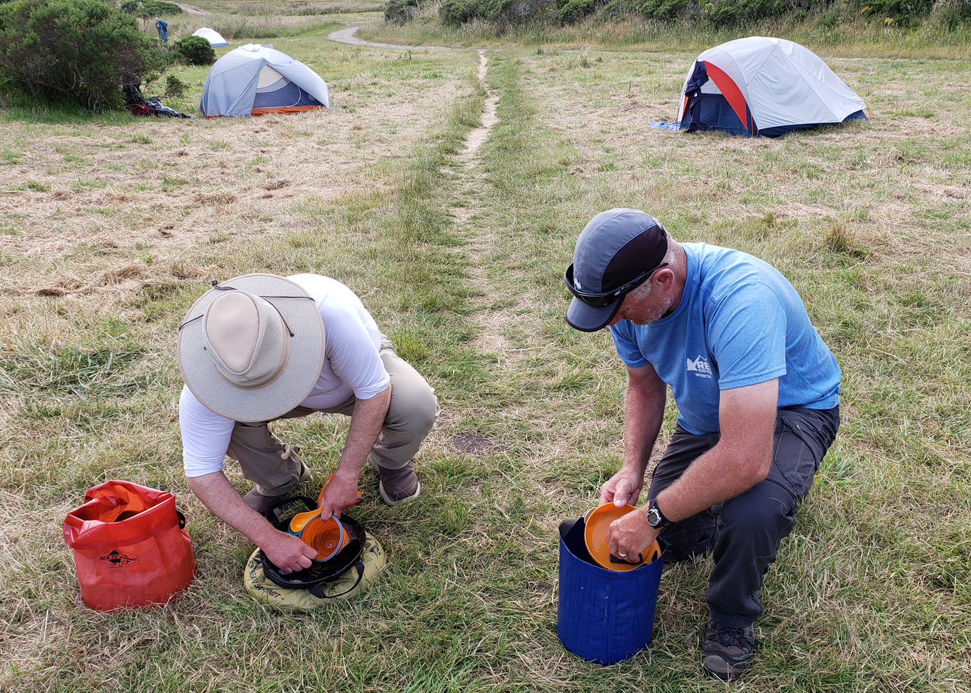
During our first two nights we will stay at a nearby campground, situated in a beautiful forest of coastal redwoods. Campsites have tables, fire rings, food storage boxes, flush toilets, and (coin-operated) hot showers. Backpacking camps will be somewhat less luxurious, but will still have tables, food lockers, easy access to potable water, and vault toilets.
The trip price includes all meals (including trail snack bags) from lunch on day one through lunch on day seven. Group camping gear will be provided. We take food seriously on this trip and make an extra effort to create appetizing meals from freeze-dried and home-dehydrated fruits and vegetables. A nutritious, high-energy diet is planned. Any food allergies or limitations should be indicated to the leader well in advance of the trip. Chicken, fish, meat-flavored soy protein, and dairy products will be on the menu. Vegetarians are welcome and all meals can easily exclude meat.
Please note: because we must pack meals for the entire group and cook them using a limited set of pots, only flexible vegans can be accommodated. If in doubt, please contact the leader to discuss any dietary restrictions beforehand to determine if they can be accommodated during this trip. Leaders will divide the group into cook crews and under their supervision, all participants will take a turn in meal preparation.
Trip Difficulty
Although this beginner’s trip is rated 2 on a scale from 1 (easy) to 5 (very strenuous), good physical conditioning is required to carry a 35-pound pack during four moving days of backpacking. Daily hiking distances between camps will vary between three and eight and a half miles. Elevation in the area fluctuates between sea level and 1,407 feet. The only major climb we have is 1,300 feet and that takes place on our first day of backpacking (day three). In order to carry your pack up hills over distances up to eight and a half miles, you must maintain a regular fitness program several months prior to the start of this trip. The leader will provide you with training suggestions to meet this goal. As with any backpacking trip, proper preparation will make your wilderness experience much more enjoyable.
Point Reyes has a Mediterranean climate and late spring-early summer is one of the best times for backpacking in this area. Daily temperatures are mild and afternoons are usually clear. Expect highs in the mid 60s to 70s and nighttime lows in the 40s or 50s. Keep in mind that morning fog is characteristic of California’s coast and because the Point Reyes peninsula extends the coastline 10 miles into the Pacific Ocean, it may feel a little cooler than other places along the shore. Participants should come prepared for fog and strong winds, especially at Chimney Rock, the Lighthouse, and at the Tule Elk Reserve.
Layered clothing is essential and will allow you to adjust to temperatures that can change quickly. Although we do not expect much rain, you must nonetheless arrive prepared with raingear (waterproof coat and pants, not ponchos). A flexible attitude is also important, in case we encounter unexpected conditions. This trip is entirely on well-maintained trails in order to avoid poison oak, stinging nettles, and ticks, which inhabit the area. Well-prepared, enthusiastic participants with an interest in backpacking, the coastal wilderness, marine biology, and the natural/cultural history of Pt. Reyes are especially welcome.
Equipment and Clothing
A detailed equipment list will be provided. Participants must furnish their own personal camping equipment, including a backpack, lightweight tent (two-person tents are lighter to carry if shared), a sleeping bag rated to at least 35 degrees, sleeping pad, reliable raingear (ponchos discouraged), backpack cover (a large garbage bag could work), layers of clothing that are comfortable between 40-70 degrees, and medium-weight, well-broken-in, waterproofed, lug-soled boots. Participants are required to bring a minimum capacity to carry two liters of water (bottles or pack bladder/reservoir). Hiking poles will be helpful on portions of rough, steep terrain.
If you are a backpack beginner, you may prefer to rent or borrow equipment for the trip from friends or a local outfitter. The leaders are happy to make gear, clothing, and equipment recommendations. Prior to departing for the trip, you should practice with your gear (e.g. setting up your tent or hiking with your pack) in order to mitigate potential problems BEFORE we are on the trail. We will weigh your personal backpack and gear to make sure you have no more than 25 pounds. You are required to carry an additional 8 pounds of the group’s commissary (i.e. camp stoves, fuel, and food) during the trip bringing your maximumk weight to 33 pounds (excluding water). Before we start backpacking, the leaders will go over packing techniques to ensure the lightest, most comfortable load possible. More information regarding personal gear may be found at the following link: http://www.knapsack.org/basic_equipment.html
References
Maps:
- Wilderness Press Recreational Map: "Point Reyes National Seashore and West Marin Parklands"
- Tom Harrison Maps: "Point Reyes National Seashore Trail Map"
Books:
- Lage, Jessica, Point Reyes: The Complete Guide to the National Seashore and Surrounding Area.
- Evens, Jules, The Natural History of the Point Reyes Peninsula.
- Gilliam, Harold, Island in Time: The Point Reyes Peninsula.
- Hart, John, Walking Softly in the Wilderness: The Sierra Club Guide to Backpacking.
- Thalman, Sylvia Barker, The Coast Miwok Indians of the Point Reyes Area.
Websites:
- Point Reyes National Seashore: www.nps.gov/pore
- Native Animals and Plants: http://www.nps.gov/pore/learn/nature
- Crowning Glories: 50 Years of Point Reyes (Bay Nature, 2012): https://baynature.org/articles/crowning-glories-50-years-of-point-reyes
- Tule Elk Reserve: https://www.nps.gov/pore/learn/nature/tule_elk.htm
- On the Fence: How the recovery of Tule elk has created a dilemma in wildlife management at Point Reyes (Bay Nature, 2015): https://baynature.org/article/on-the-fence
- Ranching History at Pt. Reyes: https://www.nps.gov/pore/learn/historyculture/people_ranching.htm
- Tamál-Húye (Drakes Bay) Archeological Project (research to understand cross-cultural encounters in the late 1500s): https://www.nps.gov/archeology/sites/npSites/pointReyes.htm
Conservation
Over the last five thousand years, the Coast Miwok people occupied the land now known as the Point Reyes National Seashore and developed over 120 known village sites along its freshwater streams. Food was abundant for the Miwok. Deer and elk, as well as grizzly (now extinct) and black bears, roamed the forests. In winter, the sky was darkened with tremendous flocks of migrating birds.
In 1579, it is believed the English explorer Sir Francis Drake landed in Pt. Reyes, on a beach that now bears his name, Drakes Beach. There, he repaired his ship and in the process, claimed the land in the name of the Queen of England. Meanwhile, Spanish galleons were regularly navigating past Point Reyes’ treacherous headlands on trading voyages between Asia and Mexico. In 1603, the Spanish explorer Sebastian Vizcaino named these headlands, “la Punta de los Reyes,” or the Point of the Kings. It was in that moment that Pt. Reyes officially appeared on maps as belonging to the Spanish Empire. By the 1800s, the Miwok people were being displaced and in 1855, Pt. Reyes’ Tule elk herds were gone. Mexican ranchos were built for cattle grazing and dairy farming. A century and a half later, many of these historic ranchos are still operating today inside the park.
After the gold rush, the city of San Francisco burgeoned. As it did, pressure to commercially develop Pt. Reyes grew. During the 1960s, a partnership was formed between Pt. Reyes ranchers and environmental organizations, including the Sierra Club, to preserve the peninsula as a National Seashore. In 1962, President Kennedy signed ”The Point Reyes Authorization Act” into law. Today, Pt. Reyes tumultuous history has melded into a landscape of mixed land uses; where both agriculture and wilderness protection coexist side by side, seemingly at peace. During our trip, we will witness this dichotomy and consider the new problems facing Point Reyes for the future. Rising sea levels, climate warming, beach trash, and invasive species are among the problems being faced by park service managers, surrounding communities, and the native inhabits of this spectacular “island in time.” As we make our way through this land’s diverse habitats, along coastal trails edged in spring flowers or lush forests hiding the past scars of wildfires, and stroll isolated beaches dotted with lively tide pools, we (as beginners) will practice our newly learned Leave No Trace principles so that we leave this place the way we found it, for others to enjoy long after our footsteps are gone.
Sierra Club National Outings is an equal-opportunity provider and when applicable will operate under permits obtained from U.S. federal land agencies.
Staff
Important Notes
- Carbon Offsets
- Carpooling
- Electronic Billing and Forms
- Electronic Devices
- Equipment
- Essential Eligibility Criteria
- How to Apply for a Trip
- Leader Gratuities
- Medical Issues
- Non-discrimination Statement
- Participant Agreement
- Seller of Travel Disclosure
- Single Supplements
- Terms and Conditions
- Travel Insurance
- Trip Feedback
- Trip Price
- Wilderness Manners