Off-Trail in the Ansel Adams Wilderness, California
Sierra Club Outings Trip | Backpack
Highlights
- Hike a challenging off trail route
- Be rewarded with spectacular views and secluded places
- Explore and relax on planned layover days
Includes
-
Tasty, vegetarian-friendly meals
-
Group cooking gear, including bear-safe food canisters
-
Trained and experienced volunteer trip leaders
Overview
The Trip
This Sierra Nevada backpack crosses the Ansel Adams Wilderness south-to-north on a cross-country adventure through classic, sparsely visited subalpine terrain. Though each year is different, chances are good that we'll see few bugs and many wildflowers! You'll enjoy grand views of the surrounding peaks, our constant companions as we hike across undulating terrain punctuated by high, secluded lakes. On two planned layover days we'll have opportunities to climb a peak and explore high valleys and lakes
The Trip
This Sierra Nevada backpack crosses the Ansel Adams Wilderness south-to-north on a cross-country adventure through classic, sparsely visited subalpine terrain. Though each year is different, chances are good that we'll see few bugs and many wildflowers! You'll enjoy grand views of the surrounding peaks, our constant companions as we hike across undulating terrain punctuated by high, secluded lakes. On two planned layover days we'll have opportunities to climb a peak and explore high valleys and lakes.
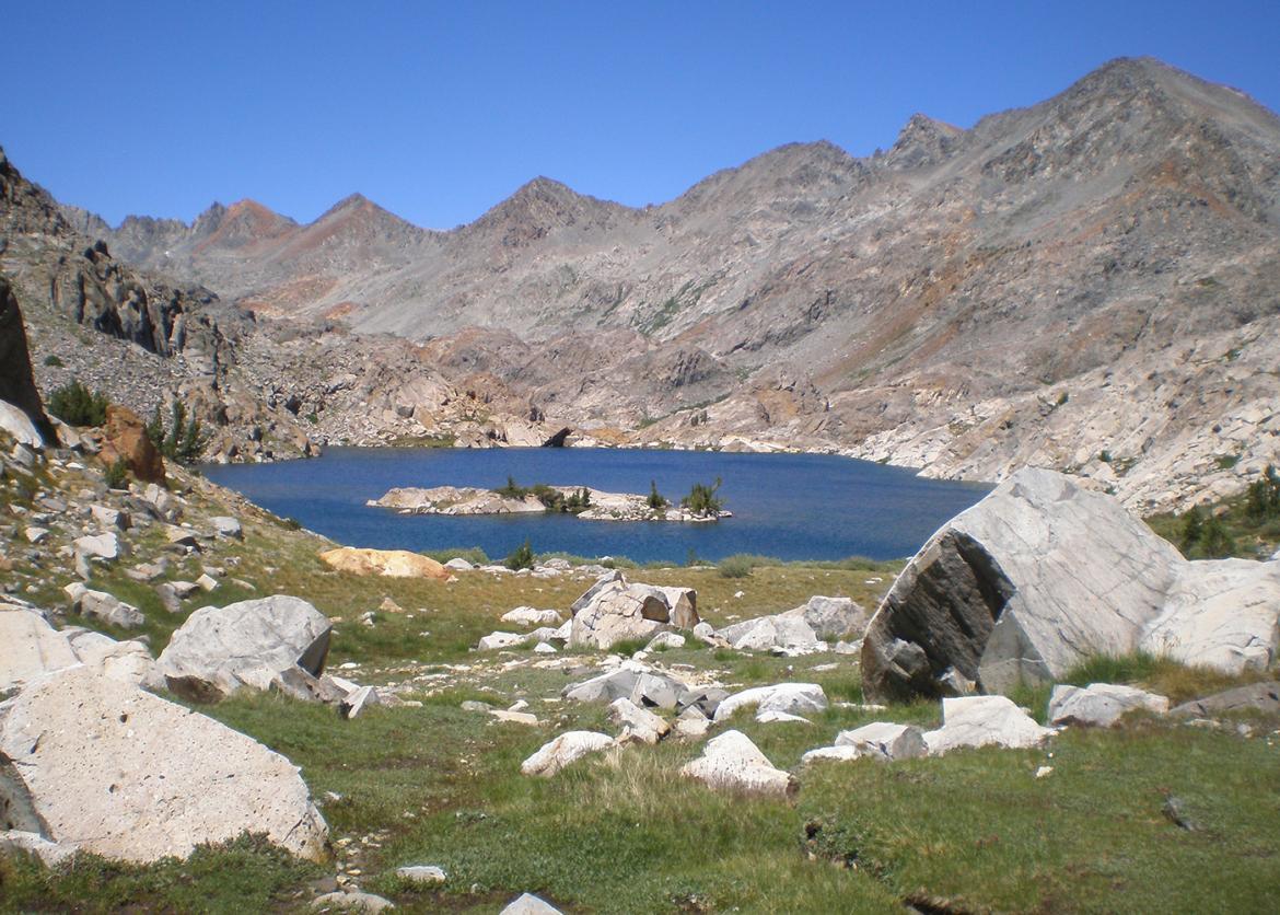
Although we start and finish our journey on major trails, we'll spend most of our time on a rugged cross-country route that crosses three major ridges. Our ultimate goal and final layover destination is Twin Island Lakes, where we'll be camped dizzyingly high above the canyon of the North Fork of the San Joaquin River. Across the canyon, massive rock walls vault hundreds of feet above our heads to form the base of the Ritter Range just beyond. From camp we can dayhike to a string of even more remote lakes to the north, or follow a "use trail" up a high valley to the next pass in the heart of the Ritter Range. This is the terrain where Ansel Adams, on a summer visit at age 23, decided that nature photography would become his life's work.
Itinerary
Our hiking schedule isn't rigid. How far we get each day and where we camp depends partly on how we feel, the weather, and other factors outside of our control. The itinerary described here should be taken as a general plan, but the actual route and daily mileage may vary. A flexible, "it's all good" attitude works best!
Day 1: We'll gather in the late afternoon at a campground near the trailhead. We'll make introductions and enjoy a group dinner together as we take care of final trip preparations and discuss the adventure ahead
Our hiking schedule isn't rigid. How far we get each day and where we camp depends partly on how we feel, the weather, and other factors outside of our control. The itinerary described here should be taken as a general plan, but the actual route and daily mileage may vary. A flexible, "it's all good" attitude works best!
Day 1: We'll gather in the late afternoon at a campground near the trailhead. We'll make introductions and enjoy a group dinner together as we take care of final trip preparations and discuss the adventure ahead.
Day 2: Early this morning, we'll serve a group breakfast before driving to the trailhead to start our hike. Although entirely on trail, this first hiking day may well be the most strenuous. It covers about eight miles and climbs roughly 2,500 feet to a camp at beautiful Joe Crane Lake. We'll be carrying our heaviest loads of the trip -- supplies for eight days -- so excellent conditioning will be required right from the start.
Day 3: This morning we immediately leave the trail to head cross-country on the slopes above Joe Crane Lake. We'll direct our steps north and east, past several picturesque subalpine lakes, toward our planned camp at McGee Lake. At lunchtime there may be time to climb a side trail to Isberg Pass, where we can look over into Yosemite.
Days 4-5: Continuing east and north, we'll cross a 10,900-foot ridge before descending very steeply to Rockbound Lake. We'll cross up and down another scenic saddle before descending to our camp. Our first planned layover day takes place in peaceful Bench Canyon. On this day we can easily climb a 12,000-foot peak near the Yosemite boundary; find a loop route around the high ridge to our south or just relax.
Days 6-7: We'll climb out of Bench Canyon, passing a small unnamed lake on our way to Twin Island Lakes, where we'll set up camp and take our second planned layover day. Dozens of lakes in the untrammeled higher basins to the north are within reach of camp. Another option is to explore the area to the east, passing below the base of Mt. Ritter toward Lake Catherine and North Glacier Pass.
Day 8: We start our exit from the high country this morning, fording the outlet of the northern Twin Island Lake and descending a few hundred feet to a little-used trail. We'll follow the increasingly well-used trail downstream to the North Fork of the San Joaquin River, continuing past the mouth of Bench Canyon to Hemlock Crossing. Here we'll take the bridge and make our last camp just across the river.
Day 9: Our final day is the longest in mileage, but it's all on trail now, and our packs are light. We start by climbing 1,000 feet from the North Fork of the San Joaquin River, but most of the rest of the day is downhill. We descend another 1,700 feet and hike a total of 10 miles before reaching our cars at the Granite Creek trailhead early in the afternoon.
Logistics
Getting There
Our trip officially starts late afternoon on Thursday. We'll gather at a campground near the trailhead for introductions, a group dinner, and final trip preparations. For acclimatization, participants are encouraged to arrive earlier and do some day hiking at altitude. Arriving well ahead of time also makes it easier to recover from random events like a missed flight connection while still making it to our starting campground in time
Getting There
Our trip officially starts late afternoon on Thursday. We'll gather at a campground near the trailhead for introductions, a group dinner, and final trip preparations. For acclimatization, participants are encouraged to arrive earlier and do some day hiking at altitude. Arriving well ahead of time also makes it easier to recover from random events like a missed flight connection while still making it to our starting campground in time.
Our trailhead is on the west side of the Sierra Nevada, about 100 miles from Fresno, California; 250 miles from the San Francisco area; and 320 miles from Los Angeles. Trip members arriving from other parts of the country should explore the option of flying to one of these major cities and sharing a rental car. A trip roster and driving directions to the trailhead campground will be sent to all participants well before the trip in order to facilitate ride sharing.
Accommodations and Food
The group leaders will plan a diverse and appealing menu to accommodate vegetarians and non-vegetarians as needed. Any food allergies or vegetarian requirements should be indicated as far in advance as possible, so the leaders can prepare the menu and pre-package all group meals. Responsibility for cooking will be shared among the trip members, with guidance from the leaders. Our first official group meal will be dinner on Day 1. The last meal of the trip will be lunch on the final day of the outing.
Trip Difficulty
The overall difficulty of the trip is rated 4 on a scale from 1 to 5, where 1 denotes the least difficult and 5 the most difficult trips.
All but one of our planned camps are between 9,500 and 10,500 feet. The off trail hiking is not technical, but there will be challenging sections that exact a price in exertion for the adventure and scenery we get in return. Altogether, we will hike close to 40 miles. About one-third of that mileage, and most hiking days, will be off trail. Some off trail sections of the trip are relatively straightforward, but there are significant stretches of rocky terrain -- some steep, some with loose footing. These sections can be tiring and demanding. Cross-country hiking requires stamina, patience, balance, and most of all, good humor.
We plan to hike four to 10 miles on travel days, with two planned layover days. We will cross several high ridges off trail. Our elevation gains will be greater than 1,000 feet on most moving days, with the maximum gain of 2,500 feet (on the first day). Greatest elevation loss in a single day is 2,100 feet (on the next-to-last day).
Our objectives are to enjoy some spectacular country and to complete the trip safely as a group. For those reasons, recent backpacking experience is a requirement, while previous cross-country experience is desirable. Safe and enjoyable hiking on this trip requires good aerobic conditioning and a patient, tolerant attitude.
Equipment and Clothing
A list of suggested personal equipment will be sent to all participants. (If you would like the list before signing up, let the leaders know and we will send you a copy.) Each person needs to keep the weight of personal gear below 25 pounds (including your backpack), aiming for the low 20s, so that, with the addition of approximately 15 to 17 pounds of commissary equipment and food, total pack weight will be less than 40 to 42 pounds at the start.
We will provide all food and cooking equipment, although you must bring your own cup, bowl, and eating utensils. Some of the group equipment is relatively bulky; particularly pot sets and bear canisters. Your pack needs to be sufficiently large to carry an item about the size of a full paper grocery bag (alternatively, four or five one-gallon milk jugs) in addition to your personal gear.
Although Sierra summers tend to be relatively dry, you must prepare for rain. Tents with a rainfly are strongly encouraged, and lightweight waterproof tarps are the required minimum for sleeping shelter. Where possible, we will help participants contact other trip members who want to share shelters. For rain gear, you should bring a waterproof jacket and rain pants rather than a poncho.
References
Maps:
The following USGS topographical quadrangles cover the entire trip: Timber Knob, Mt. Lyell, Mt. Ritter, and Cattle Mountain. Single maps of the entire area include the Ansel Adams Wilderness map published by Tom Harrison Maps or the Ansel Adams Wilderness map put out by the U.S. Forest Service.
Books:
- Roper, Steve, The Sierra High Route: Traversing Timberline Country (The Mountaineers Books). Part of our trip goes on the route he describes in Bench Canyon and near Twin Island Lakes.
- Secor, R.J., The High Sierra: Peaks, Passes, and Trails (The Mountaineers Books). This is an excellent general reference to climbing routes, cross-country routes, and trails in the Sierra Nevada.
- Laws, John Muir, The Laws Field Guide to the Sierra Nevada (California Academy of Sciences). This is a general reference to Sierra life. It covers trees, wildflowers, fish, reptiles, amphibians, birds, mammals, and other life in the mountains.
Conservation
In 2014, America celebrates the 50th anniversary of the Wilderness Act. Although the Act was far in the future when our Outings program started, the Sierra Club was already working to forever protect certain wild places from human developments. This is the basic principle on which the Sierra Club was founded, and for which the Wilderness Act was conceived. On our trip, we'll take some time to reflect on how the Wilderness Act has aided in setting aside this beautiful mountainous region for us to enjoy.
On our visit to this beautiful wilderness, we’ll live the Sierra Club motto: “Explore, enjoy and protect the planet.” In the spirit of both the motto and the Wilderness Act, we'll minimize our impact by being mindful of, and practicing, the Leave No Trace ethic.
Sierra Club National Outings is an equal-opportunity provider and when applicable will operate under permits obtained from U.S. federal land agencies. Sierra Club Outings operates this activity under a U.S. Forest Service special use permit in the Sierra National Forest.
Staff


Important Notes
- Carbon Offsets
- Carpooling
- Electronic Billing and Forms
- Electronic Devices
- Equipment
- Essential Eligibility Criteria
- How to Apply for a Trip
- Leader Gratuities
- Medical Issues
- Non-discrimination Statement
- Participant Agreement
- Seller of Travel Disclosure
- Single Supplements
- Terms and Conditions
- Travel Insurance
- Trip Feedback
- Trip Price
- Wilderness Manners