Backpacking the Sierra High Routes Southern Terminus, Sequoia Kings Canyon National Park, California
Highlights
- Trek the southernmost 30 miles of Roper's High Route
- Explore 3 lake-filled basins: Granite, Lake, and Upper
- Traverse famously tough Frozen Lake Pass
Includes
-
Healthy, varied, vegetarian friendly meals
-
Seasoned leadership, permits and pre-trip camping
-
A fit group that relishes moving high, fast and light
Overview
The Trip
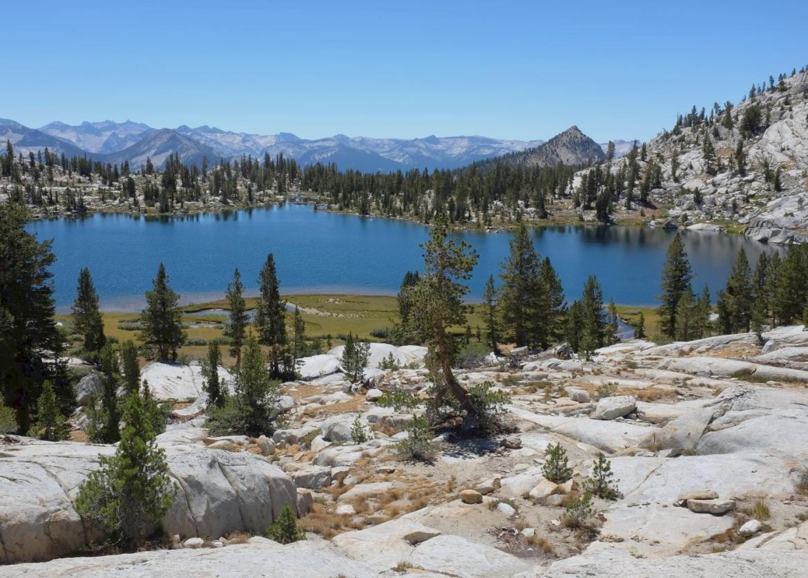
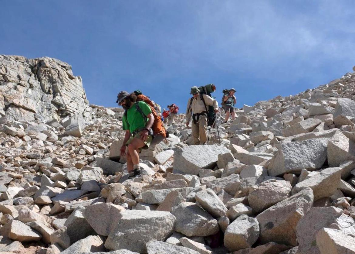
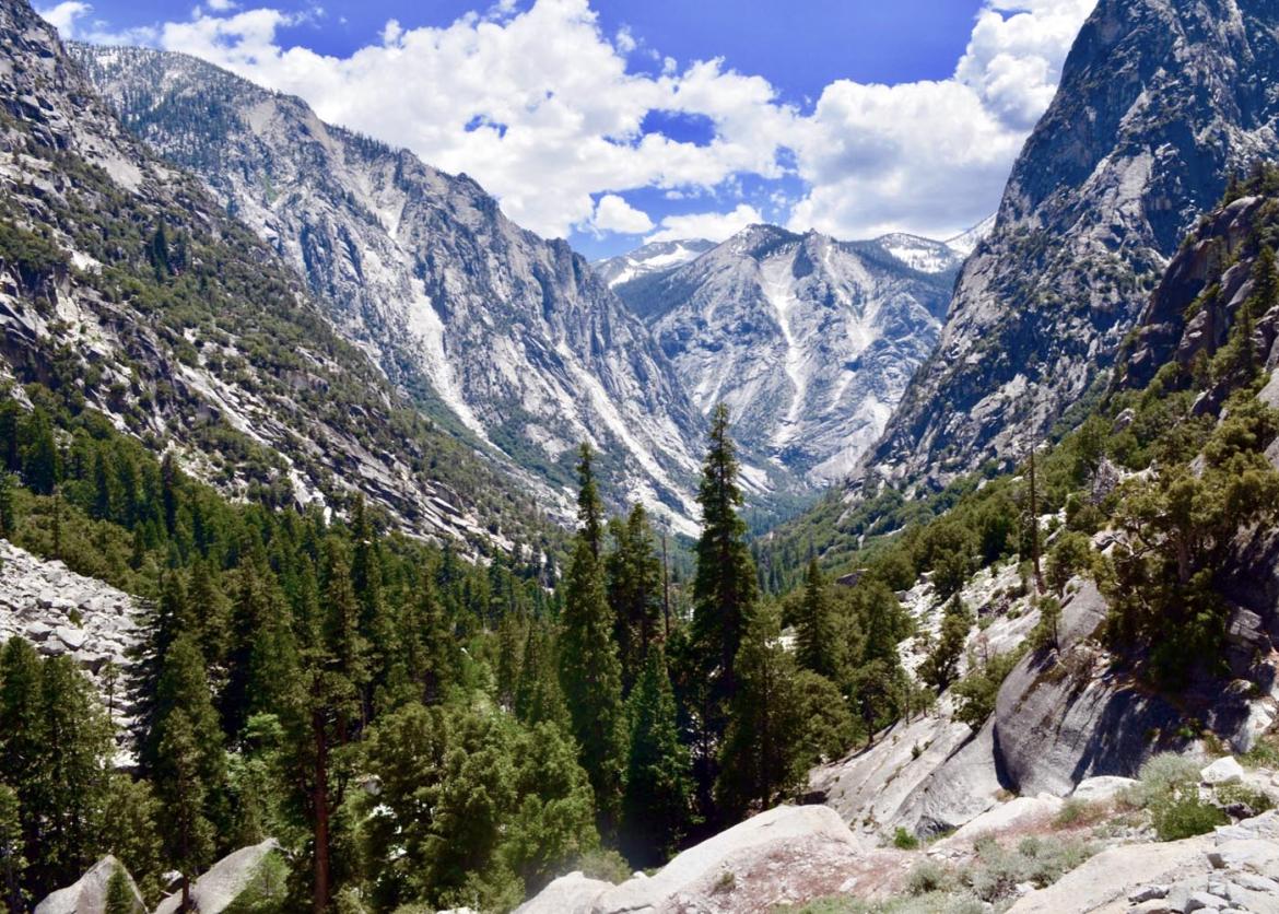
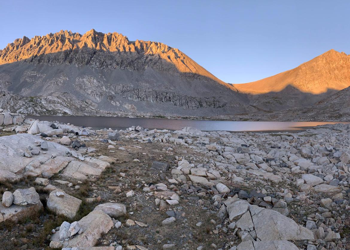
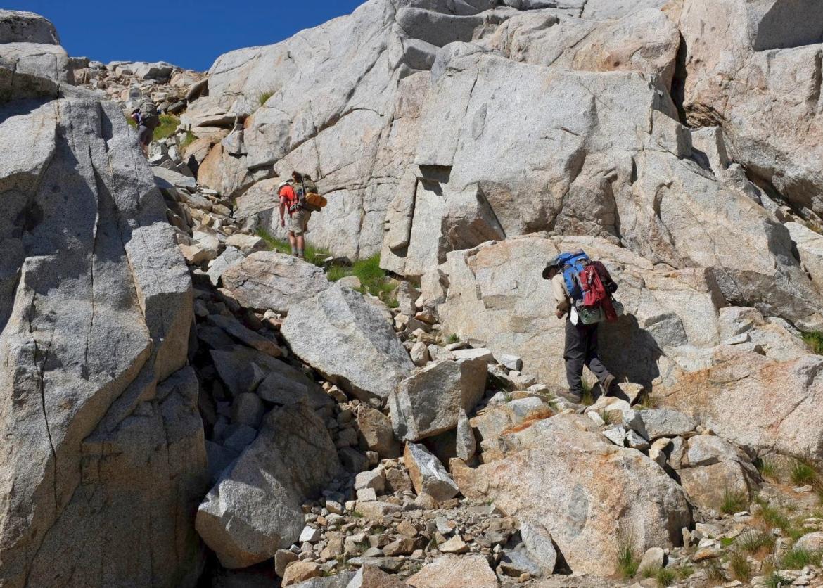
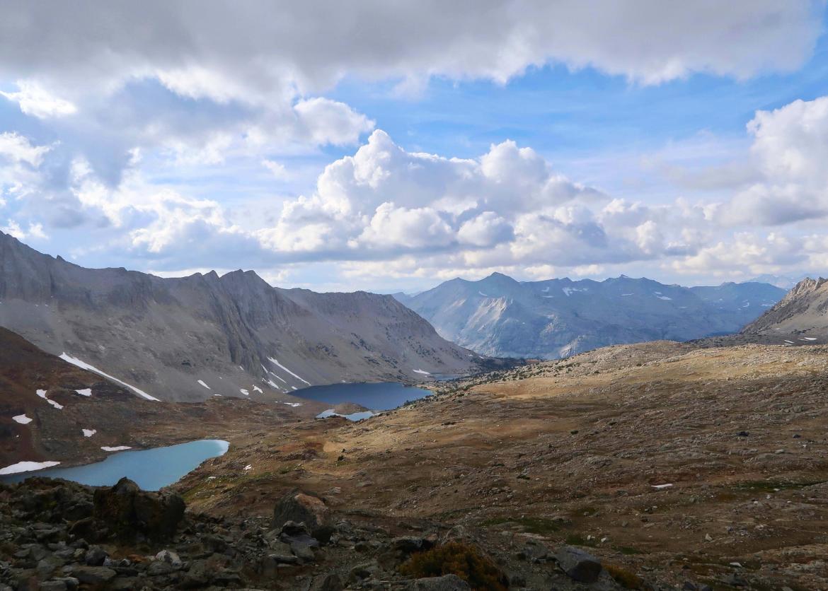
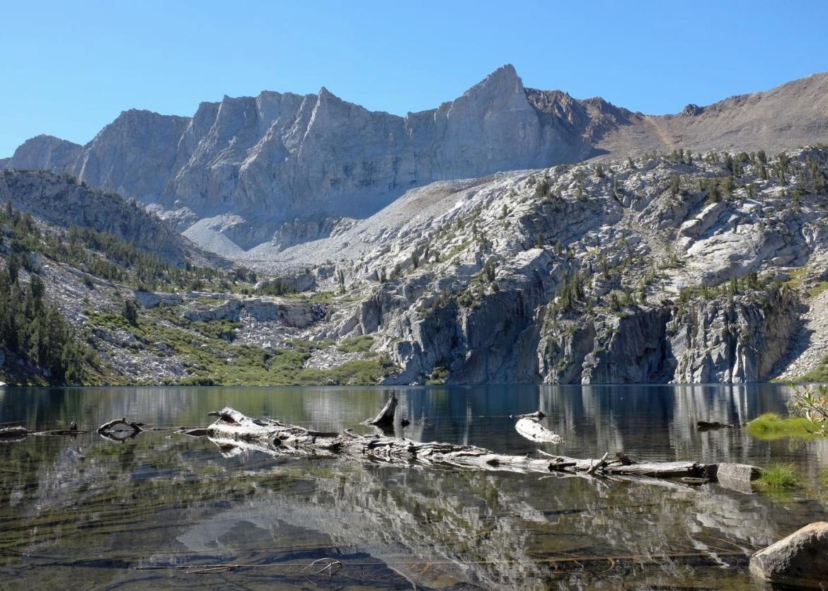
Backpacking more than 55 miles of iconic Kings Canyon National Park backcountry, our intrepid group will negotiate class 3 scrambles, talus slopes, and huge boulder fields while passing through an alpine wonderland of granite spires, glacier-carved valleys, and turquoise lakes. An additional 25 miles or so of hiking on two layover days will provide opportunities to explore remote Lake and Granite Basins.
The inspiration for this trip comes from many sources. Chief among them is a conceptual route along the crest of the Sierra Nevada that parallels the famed John Muir Trail, but goes higher, stays higher, and keeps off-trail to the greatest extent possible. By “conceptual,” we mean that there’s no set path or trail to follow, only general guidelines and landmarks -- some key destinations linked together through a desire to stay as close to timberline as possible (timberline being that variable elevation where the trees thin out, a narrow band between forest and exposed granite)
The Trip
Backpacking more than 55 miles of iconic Kings Canyon National Park backcountry, our intrepid group will negotiate class 3 scrambles, talus slopes, and huge boulder fields while passing through an alpine wonderland of granite spires, glacier-carved valleys, and turquoise lakes. An additional 25 miles or so of hiking on two layover days will provide opportunities to explore remote Lake and Granite Basins.
The inspiration for this trip comes from many sources. Chief among them is a conceptual route along the crest of the Sierra Nevada that parallels the famed John Muir Trail, but goes higher, stays higher, and keeps off-trail to the greatest extent possible. By “conceptual,” we mean that there’s no set path or trail to follow, only general guidelines and landmarks -- some key destinations linked together through a desire to stay as close to timberline as possible (timberline being that variable elevation where the trees thin out, a narrow band between forest and exposed granite). Such a route had been sought and achieved in small pieces, over decades of early trips into the high backcountry of the Sierra but was first described cohesively by famed mountaineer and writer Steve Roper, in his 1982 work, Timberline Country, The Sierra High Route.
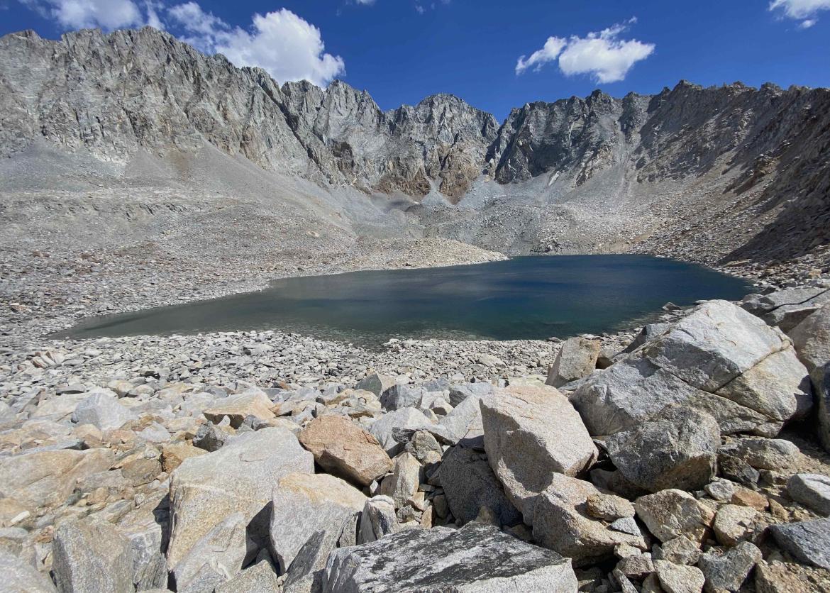
Our trip will start along Copper Creek at Road’s End in Kings Canyon. Moving steeply up the nicely graded trail, we’ll climb a vertical mile before peeling away toward Grouse Lake, where the High Route departs the trail for the first time along its 195-mile entirety. Here the real fun begins! Over the next few days, we traverse seven cross-country passes, some steep and talus-filled. We encounter these tough but manageable sections of jumbled granite boulder fields frequently along the route. Agility, balance, and surefootedness are essential to move through these areas safely and nimbly. Roper considers the final pass, Frozen Lake Pass, one of the three most difficult along the 195-mile High Route. Traversing it as we move from remote Lake Basin to Upper Basin will be a memorable achievement.
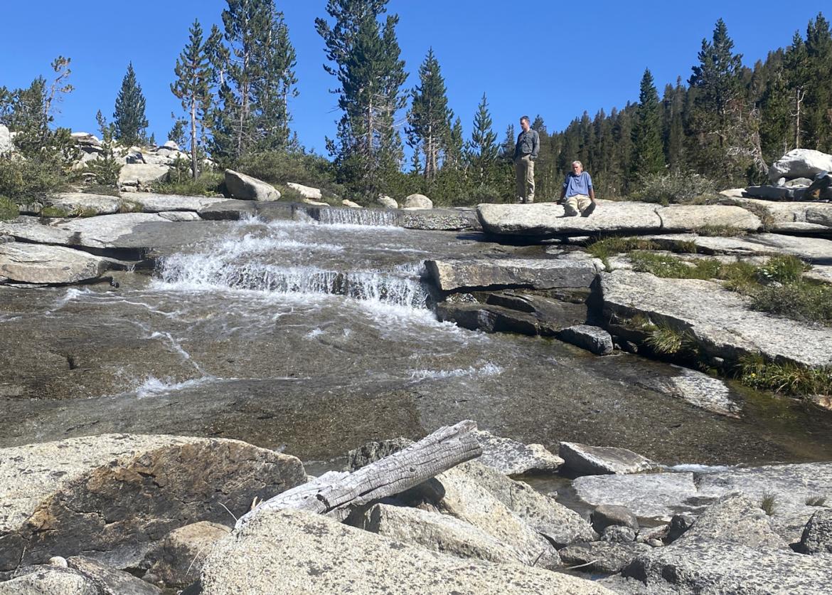
Upon entering Upper Basin, we will be in the shadow of multiple 14ers, including Split Mountain and those of the Palisades group, an awesome sight. After a few more miles, the High Route joins the John Muir Trail (JMT) to head north over Mather Pass. At this junction, we head south on the JMT, over Pinchot Pass, then follow Woods Creek Trail, heading down through Paradise Valley to complete our 55-mile loop. As we head back around, we intend to camp at idyllic Bench Lake, where we will take in grand views of the Cirque Crest and Arrow Peak. Our last camp, in Paradise Valley, will be near several swimmable water features, including Woods Creek Waterslide.
This is a strenuous trip, with significant elevation gain and loss, and most hiking is done away from established trails. Hiking terrain will be loose, steep, and exposed in some sections, and several stream crossings may require some wading. It is intended for participants with previous backpacking experience at altitudes above 10,000 feet, although super-fit novice backpackers are welcome to apply.
Sequoia and Kings Canyon National Parks are the homelands of the Mono (Monache), Yokuts, Tübatulabal, Paiute, and Western Shoshone. Native peoples have used, tended, occupied, and valued the lands of the High Sierra in many ways, and still maintain deep connections to the parks today. Despite displacement and often forced relocation and reorganization, these tribes all have numerous descendants living today who continue to steward and tend to the lands now within Sequoia and Kings Canyon National Parks.
Itinerary
Our hiking schedule is not rigid. How far we get each day and where we camp depends on group strength, the weather, and other factors outside of our control. Flexibility is important. The itinerary described here should be taken as a general plan -- the actual route and schedule may change. Those who acclimatize slowly would benefit from coming a few days early to make the first days of the trip more enjoyable.
Day 1: The trip begins and ends at the relatively low elevation of 5,000 feet in Kings Canyon National Park, at Road’s End (the east end of Highway 180). We will meet early evening at a campground near Cedar Grove (TBD), where we will have a group meeting. Dinner is on your own and can be eaten anytime, including during the meeting. All group gear and food will be distributed. The campground and permit will be reserved 6 months before the trip so do not make final travel plans until then
Our hiking schedule is not rigid. How far we get each day and where we camp depends on group strength, the weather, and other factors outside of our control. Flexibility is important. The itinerary described here should be taken as a general plan -- the actual route and schedule may change. Those who acclimatize slowly would benefit from coming a few days early to make the first days of the trip more enjoyable.
Day 1: The trip begins and ends at the relatively low elevation of 5,000 feet in Kings Canyon National Park, at Road’s End (the east end of Highway 180). We will meet early evening at a campground near Cedar Grove (TBD), where we will have a group meeting. Dinner is on your own and can be eaten anytime, including during the meeting. All group gear and food will be distributed. The campground and permit will be reserved 6 months before the trip so do not make final travel plans until then.
Day 2: We’ll rise very early for an alpine start. After a quick breakfast, the first provided meal, we’ll begin hiking up Copper Creek by 4 or 5 a.m. Starting at a relatively low elevation on a sun-exposed trail requires an early start to avoid brutal heat. We expect to climb around 2,000 feet, to where it is cooler and more shaded before the sun is upon us. The 5,500-foot climb to Grouse Lake is about 9 miles, mostly on a nicely maintained, well-graded trail. The views along the way are stupendous, making the miles pass quickly. Grouse Lake (10,500 feet) is renowned for having one of the best views in all of the Sierra -- featuring sunset, sunrise, and a lake view spread out below. It’s worth the effort of the entire trip to get there.
Day 3: We’ll explore the Granite Basin and visit Granite and Volcano Lakes on a well-deserved layover day. Climbing a peak or visiting Shorty’s Granite Pass Cabin are additional possibilities. We will hike up to 13 miles and 3,000 feet of elevation change, fortunately with only day packs.
Day 4: Travelling off-trail we will cross Grouse Lake Pass and Goat Crest Saddle, good warmups for the more difficult crossings later in the trip. Tramping through lake-filled Glacier Valley, numerous glacier-carved granite cirques will tower above our group as we meander to Horseshoe Lakes to camp. We’ll hike about 9 miles with about 2,300 feet of elevation change.
Day 5: This will be a day filled with challenges and rewards. We’ll work our way over three high, rugged cross-country passes -- Grey, White, and Red -- en route to Marion Lake, purportedly the bluest lake in the Sierra. We’ll make camp here or perhaps choose from one of the other fine lakes in the remote Lake Basin. The lake’s namesake is Helen Marion LeConte, who explored here with her husband (Joseph) in the early 1900s. The day will be about 7 miles with around 2,500 feet of elevation change, all off-trail.
Day 6: We’ll enjoy a layover day with the opportunity to explore the incredible Lake Basin. Fishing is good here, and there are more lakes than anyone can visit in a single day. Hiking up Cartridge Pass (11,800 feet) to look for the original JMT, now relocated, will be one of our day hikes. The views are incredible from the top.
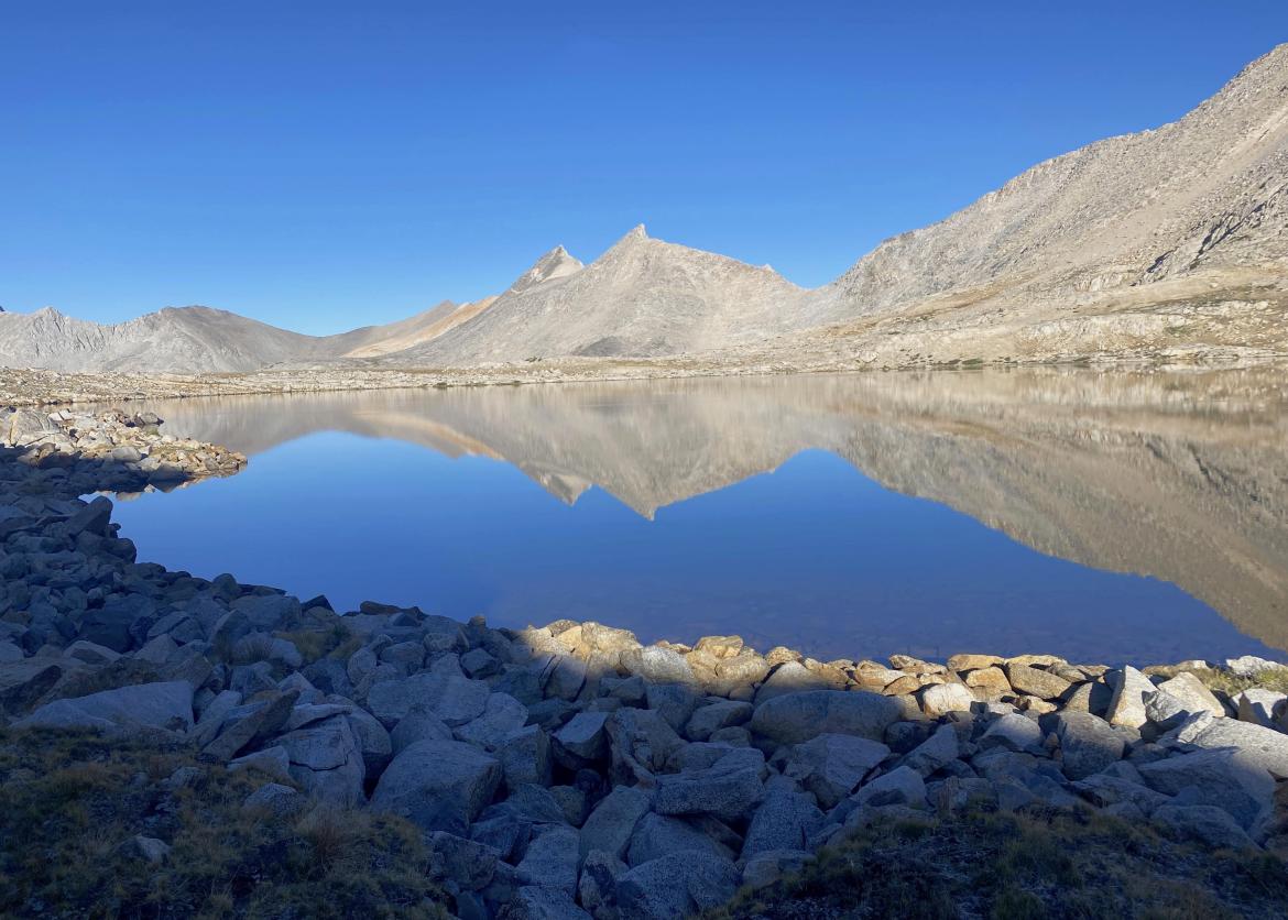
Day 7: Today we traverse the entirety of Lake Basin, then exit by gradually and carefully working our way up and over Frozen Lake Pass. It is very steep on the north side and may have patches of snow. Older descriptions, including that of Secor, describe the traverse as “always requiring ice axe and crampons” and claim “the lake is always frozen." Fortunately for our trip, but unfortunately for the health of the Sierra, that is no longer true due to climate change. In 2021 the lake was not frozen, and the pass was snow-free in late June. Later in the summer, it should be passable, even in big snow years. The pass takes us into Upper Basin where we’ll head toward the Palisades group until we hit the John Muir Trail, and then head south. A short spur off the JMT will lead us to an exquisite campsite at Bench Lake (10,500 feet) with spectacular views of Arrow Peak. Today we’ll hike about 9 miles, gain 3,000 feet, and descend 2,800 feet.
Day 8: Heading down from Bench Lake to the JMT, we’ll turn south, traverse Pinchot Pass, and head toward the Woods Creek Trail junction before descending generally westward toward Paradise Valley. There are numerous water features and swimming holes along the way to break up the day and cool off. We will camp in the vicinity of Castle Domes, after hiking 12 miles with 1,500 feet of elevation gain and 3,600 feet of loss.
Day 9: Today we’ll get a very early start to hike down through Paradise Valley and back to our cars. The area is a true paradise of water features, which will allow us to cool off at will during our 14-mile and 4,000-foot gradual descent.
Logistics
Getting There
The trip begins in the afternoon at a campground near Cedar Grove in Kings Canyon National Park. If available, the leader will reserve the campsite for one additional night for all who wish to arrive the day before our first meeting (two days before starting to backpack). It is highly recommended that you arrive early and do some hiking to better acclimatize before the big first backpacking day.
Cedar Grove/Road’s End is located on the western side of the Sierra Nevada, usually accessed from Visalia or Fresno, and both are located in the San Joaquin Valley about 2.5 hours away. The nearest airport is Fresno and flights there are often cost competitive with larger airports. Although a shuttle can be taken to Sequoia NP from Visalia, no shuttles are available to Cedar Grove/Road’s end. An UBER from Fresno airport would likely cost $200-250, so rental car sharing or getting a ride with another trip participant would be more economical
Getting There
The trip begins in the afternoon at a campground near Cedar Grove in Kings Canyon National Park. If available, the leader will reserve the campsite for one additional night for all who wish to arrive the day before our first meeting (two days before starting to backpack). It is highly recommended that you arrive early and do some hiking to better acclimatize before the big first backpacking day.
Cedar Grove/Road’s End is located on the western side of the Sierra Nevada, usually accessed from Visalia or Fresno, and both are located in the San Joaquin Valley about 2.5 hours away. The nearest airport is Fresno and flights there are often cost competitive with larger airports. Although a shuttle can be taken to Sequoia NP from Visalia, no shuttles are available to Cedar Grove/Road’s end. An UBER from Fresno airport would likely cost $200-250, so rental car sharing or getting a ride with another trip participant would be more economical. As the trip nears, we will provide a trip roster to aid in arranging transportation for those not driving their vehicles. SFO and LAX are both 280 miles from Cedar Grove, about 5-6 hours depending on traffic.
Specific driving directions and campsite meeting instructions will be sent out to trip participants a couple of months before departure. Please do not make non-refundable travel arrangements until notified to do so by the trip leader.
Accommodations and Food
The leaders are experienced in planning tasty, nutritious, and lightweight fare. We can accommodate some, but not all dietary restrictions and preferences. It’s your responsibility to indicate any special dietary requirements on your trip application. All food and equipment for preparing meals is provided. Participants need to bring their mug, bowl, utensils, snacks, water treatment, and water containers. Trip members are on their own for meals at the campground, until breakfast our first backpacking day. At the trip’s end, you might want to treat yourself to a hot shower at Cedar Grove.
Trip Difficulty
This trip is rated 5, the most difficult rating applied to Sierra Club backpack trips. It won’t be the hardest of fives, so to speak, but will nonetheless present rigors and challenges, especially when moving cross-country away from established trails. We will hike up, over, and down steep, loose terrain at different times and cross several cold streams. This trip is best suited to backpackers with previous experience hiking on steep loose terrain, at elevations above 10,000 feet.
We will travel 55 miles while climbing and descending about 15,000 feet on our six backpacking days. Twenty-five of those miles will be off-trail and involve crossing seven cross-country passes, some with significant sections of talus. The two layover days will likely add another 25 miles and 5,000 feet of elevation change.
All trip members must be in excellent physical condition before the trip starts. Once underway, it will be awkward and disruptive to escort ill-conditioned hikers off the trip. It’s also unfair to all who put in the effort to condition properly for others to show up out of shape. Proper conditioning consists of regular practice hikes with a loaded pack and the boots you plan to wear in the months before the trip -- not something that can just be crammed in the weekend before the trip. Well-conditioned hikers generally prefer a better-than-average pace with less frequent breaks than most Sierra Club outings.
Equipment and Clothing
We will send a list of suggested personal equipment to all participants. Each person should keep the weight of personal gear below 20 pounds (not including what is worn to the trailhead, footwear, and trekking poles). With the addition of approximately 13-14 pounds total of food, a bear-resistant canister, group gear, and 2 quarts of water, the total pack weight should be less than 38 pounds at the start.
We will provide all food and cooking equipment, but you must bring your cup, wide-mouth bowl, and eating utensils. Some of the group equipment is relatively bulky, particularly pots and bear canisters. Your pack should be sufficiently large to carry an item about the size of a full paper grocery bag (alternatively, four or five one-gallon milk jugs) in addition to your gear. A 60–75-liter pack tends to be ideal.
Although Sierra summers are generally relatively dry, we still must be prepared for rain. For shelter, tents are strongly encouraged, and lightweight waterproof tarps are the required minimum. For clothing, you should bring a waterproof jacket and pants rather than a rain poncho. Ankle-high boots are the norm; however, very experienced backpackers who wish to wear lighter footwear may do so after a discussion with the leader.
Replacing older, heavier gear with newer lighter gear is helpful to lighten your load and make the trip more enjoyable. The leader is happy to make suggestions.
References
Maps:
Compass and maps are not required, as the leaders will be carrying these; however, they are highly recommended and required if you plan to venture out on layover days without one of the leaders. There are four USGS 7.5-minute series topographic maps that cover our route: The Sphinx, Marion Peak, Mount Pinchot, and Mount Clarence King. Some leaders prefer to use electronic navigation, reserving paper maps for backup. Gaia GPS is quite popular, and the paid version (“Premium”) is necessary to be able to download offline maps. There is no cell service on our route so maps must be downloaded to the phone before the trip. The leader can provide help.
For a good overview of the area in which we will travel:
- “Kings Canyon High Country," Tom Harrison Maps, 1:63,000 scale, 2021
- “Sequoia Kings Canyon National Parks (Map 205)," National Geographic Trails Illustrated Topographic Map. 1:80,000 scale, 2020
Books:
- Secor, R.J., The High Sierra: Peaks, Passes, and Trails. The Mountaineers. An excellent general reference to trails, cross-country routes, and climbing routes in the Sierra Nevada.
- Roper, Steve, Sierra High Route -- Traversing Timberline Country (2nd Ed, 1997). The Mountaineers. Includes a guide to much of our planned route.
- Laws, John Muir, The Laws Field Guide to the Sierra Nevada. Heyday Books. An excellent field guide to the plants and wildlife of the Sierra.
- Clyde, Norman, Close Ups of the High Sierra. Gives the flavor of early mountaineering in the Sierra (2007).
- Robinson, Kim Stanley, The High Sierra, A Love Story. Little Brown and Co. Fantastic read for any backpacker. (2022).
Conservation
“If future generations are to remember us with gratitude rather than contempt, we must leave them something more than the miracles of technology. We must leave them a glimpse of the world as it was in the beginning, not just after we got through with it." -- President Lyndon B. Johnson, on the signing of the Wilderness Act of 1964.
The Act defines "wilderness" as "an area where the earth and its community are untrammeled by man, where man himself is a visitor." This important act first established the National Wilderness Preservation System, originally protecting nine million acres of national forest lands. Today some 112 million acres are encompassed by the system, including the Sequoia and Kings Canyon Wilderness, where we will be "visitors" for all eight days of our hike. This wilderness area has “double protection," having had some protection based on its National Park status, since 1940. However, the surrounding national forest lands do not receive the same level of protection. We will examine and consider the level of protection that wilderness designation has given to this area, appreciate how this land compares with other types of "protected" areas we are familiar with, and discuss how we should protect these areas for future generations.
The Sierra Club is an environmentally focused entity. We are concerned about the conservation and sustainability of resources, both locally and globally. Our work is accomplished by volunteers and aided by a salaried staff, encouraging grassroots involvement. Our outings seek to empower participants toward greater understanding, advocacy, and participation in the goals of the Club. The Sierra Club is currently working extensively on habitat protection and combating climate change: "Climate change is the largest threat that our natural heritage has ever faced. The effects of climate disruption are already being felt on even our most pristine landscapes.” We'll have an opportunity on our outing to discuss environmental issues, the importance of large, protected areas for habitat resilience, and what we can do to support work on these issues. Participants are also encouraged to share information about other environmental issues, such as those in their local communities.
Since the days of John Muir, the Sierra Club has believed that its outings program provides a perfect opportunity for members to both enjoy the fruits of past conservation victories and learn about current concerns. Visitors like us impact the wilderness. Our trip will provide a good opportunity to consider why it’s important to minimize this effect and how to do so. We will also discuss how wilderness practices have changed over the years and how they can be further improved while at the same time allowing for a special experience.
Sierra Club National Outings is an equal opportunity provider and when applicable will operate under permits obtained from U.S. federal land agencies.
Staff
Map
What Our Travelers Say
Christopher O, Hayward, Ca
Gorgeous off trail lakes and passes
I really enjoy the environmental discussions and respect for divergent opinions that our group developed. The world has many voices and we need to hear them all. We stayed near some of the most interesting and gorgeous lakes that I have ever...
Christopher O, Hayward, Ca
Gorgeous off trail lakes and passes
How was the quality of the volunteer leadership?
Sierra Club volunteer leaders may as well be professionals. They are passionate, environmentally aware and great at group dynamics. Our safety was paramount. Food was always good and plentiful with special dietary needs accommodated.
What was the highlight of your trip? Any advice for potential travelers?
We had wonderful discussions in and about wilderness, in gorgeous wilderness settings. I especially enjoyed Grinnell Lake, a triple cirque.
Have you taken a trip with us recently? If so, look for an email to submit a review, or email us to find out how to submit.
Important Notes
- Carbon Offsets
- Carpooling
- Electronic Billing and Forms
- Electronic Devices
- Equipment
- Essential Eligibility Criteria
- How to Apply for a Trip
- Leader Gratuities
- Medical Issues
- Non-discrimination Statement
- Participant Agreement
- Seller of Travel Disclosure
- Single Supplements
- Terms and Conditions
- Travel Insurance
- Trip Feedback
- Trip Price
- Wilderness Manners

