Northern Yosemite Lakes, Meadows, and Peaks Adventure, California
Sierra Club Outings Trip | Supported Trekking
Highlights
- Hike through six stunning mountain passes
- Swim in pristine lakes surrounded by gorgeous mountains
- Enjoy cross-country hikes to lakes on layover days
Includes
- All meals from dinner on day one to lunch on the last -icon-: Meals
- Pack animals, wranglers, and a dedicated cook -icon-: Gear/equipment (kayak, tent, safety)
- Gratuities for packer’s staff -icon-: Gratuities/donation
Overview
The Trip
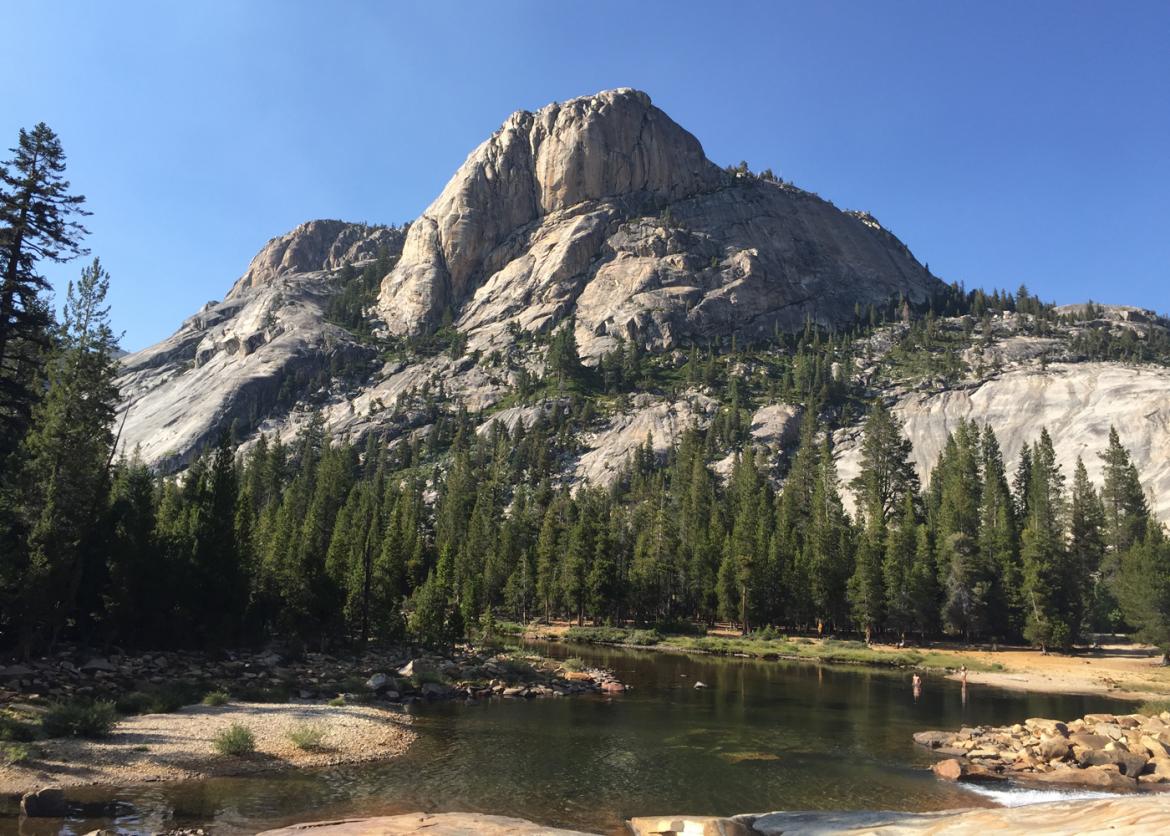
If you have ever wanted to hike in the backcountry of northern Yosemite but did not want to carry a heavy pack this is probably the trip for you. Let mules carry your gear as you hike through this beautiful section of northern Yosemite National Park. Each day we will have opportunities to fish or swim in cool mountain creeks or pristine lakes as we hike though spectacular mountains, canyons, and meadows.
This wilderness adventure begins Tuesday, August 2 at 4:00 p.m. and we’ll spend the first evening of our trip camping near the Virginia Lakes Trailhead. The campsite location will be sent to trip members at a later date. Meeting prior to the trip will allow us to acclimate to the high elevation and get acquainted
The Trip
If you have ever wanted to hike in the backcountry of northern Yosemite but did not want to carry a heavy pack this is probably the trip for you. Let mules carry your gear as you hike through this beautiful section of northern Yosemite National Park. Each day we will have opportunities to fish or swim in cool mountain creeks or pristine lakes as we hike though spectacular mountains, canyons, and meadows.
This wilderness adventure begins Tuesday, August 2 at 4:00 p.m. and we’ll spend the first evening of our trip camping near the Virginia Lakes Trailhead. The campsite location will be sent to trip members at a later date. Meeting prior to the trip will allow us to acclimate to the high elevation and get acquainted.
The next morning, we pack our gear and deliver it to the pack station as we head out to begin our first hike into Yosemite National Park. We pass several beautiful lakes as we make our way up the first Burro Pass and Summit Lake that are located in the Hoover Wilderness. Afterward, we drop down into the Virginia Canyon within Yosemite National Park and spend the second night camped along Return Creek. We continue on through Virginia Canyon and soon join the Pacific Crest Trail for a few miles before reaching the next campsite. The following day, we begin hiking a loop up through Matterhorn Canyon, over Burro, Mule, and Rock Island passes and down through Kerrick Meadows. We cross Seavy Pass and Benson Pass before completing the loop, and move farther south to Glen Aulin. While in Glen Aulin, we hope to spend a leisurely day in camp or take a walk to Watherwheel before completing the journey in Tuolumne Meadows the last day. This is one of the truly beautiful areas of Yosemite. Join us for an exciting mule-supported hiking experience as we walk through a magnificent section of northern Yosemite.
Itinerary
Day 1: Meet at campground near Virginia Lakes (9,200 feet elevation).
Day 2: Virginia Lakes to Return Creek (7 miles / 1,433-foot gain / 1,742-foot loss). Today we will cross our first pass, unofficially called Burro Pass. We hike past several lakes and have spectacular views as we move toward Virginia Canyon and our first night in Yosemite National Park.
Day 3: Return Creek to Miller Lake (8 miles / 1,142-foot gain / 906-foot loss). We hike through Virginia Canyon along Return Creek until we join the Pacific Crest Trail and continue to Miller Lake. We will ascend a section of rocky switchbacks through some forested and open areas before reaching camp
Day 1: Meet at campground near Virginia Lakes (9,200 feet elevation).
Day 2: Virginia Lakes to Return Creek (7 miles / 1,433-foot gain / 1,742-foot loss). Today we will cross our first pass, unofficially called Burro Pass. We hike past several lakes and have spectacular views as we move toward Virginia Canyon and our first night in Yosemite National Park.
Day 3: Return Creek to Miller Lake (8 miles / 1,142-foot gain / 906-foot loss). We hike through Virginia Canyon along Return Creek until we join the Pacific Crest Trail and continue to Miller Lake. We will ascend a section of rocky switchbacks through some forested and open areas before reaching camp.
Day 4: Miller Lake to Upper Matterhorn (5 miles / 1,367-foot loss / 2,113-foot gain). Leaving Miller Lake, we head north into Matterhorn Canyon and set up camp midway through the canyon. This is a short mileage day, but it has some high elevation gains.
Day 5: Upper Matterhorn to Slide Canyon (6 miles / 1,500-foot gain / 1,300-foot loss). Today we have those stunning views of Whorle Mountain, Mattahorn Peak, and Finger Peaks. We also cross our highest elevation of 10,650 feet at Burro Pass.
Day 6: Slide Canyon to Upper Kerrick (8 miles / 1,643-foot gain / 1,600-foot loss). This is a big day with more striking views. It really can take your breath away. We cross Mule Pass and Rock Island Pass, making a stop at Snow Lake along the way. We will be entering the Hoover Wilderness briefly and then cutting back into Yosemite National Park on the west side of Snow Lake. Our Camp will be in Upper Kerrick near Peeler Lake. An alternate hike to camp would be to bypass Rock Island Pass and Snow Lake and continue past Crown Lake and Robinson Lakes, then head northwest to Peeler Lake, accessing it from the north entrance. Camp is slightly southwest of Peeler Lake.
Day 7: Upper Kerrick to Benson Lake (10 miles / 265-foot gain / 1,800-foot loss). This is a long mileage day as we hike through a series of meadows. We begin by retracing the first mile and a half of Upper Kerrick. Farther along, we pass some excellent water pools in Lower Kerrick Canyon, where we can dip our feet or take a plunge. We follow the trail to cross Seavy Pass and then hike by several small lakes before descending to Benson Lake. Benson has sandy shores, making it tropical in appearance; it’s an excellent place to swim.
Day 8: Benson Lake to Smedberg Lake (4.8 miles / 1,880-foot gain / 241-foot loss). There may be an opportunity to see deer today as we depart the area. It’s a shorter day with a stiff climb to a gorgeous lake, where we camp for two nights. En route, there is an opportunity to visit Murdock or Rogers lakes; they are a short distance from the top of the pass.
Day 9: Layover Day, Sisters Lake or Rogers Lake. This is a day to lounge in camp, fish, or do a cross-country hike up to some other nearby lakes.
Day 10: Smederg to Miller Lake (8 miles / 2,130-foot gain / 1,890-foot loss). Today completes our loop before we begin our journey south to Glen Aulin and Tuolumne Meadows. We start by crossing some meadows, but quickly ascend about 900 feet in two miles. We reach Benson Pass and then descend down rocky switchbacks back into Matterhorn Canyon before reaching today’s destination.
Day 11: Miller Lake Lake to Glen Aulin (11.9 miles / 755-foot gain / 2,386-foot loss). This is our longest hiking day. We have a few areas to ascend, but it is more about the descent. Glen Aulin is more heavily used, but should not be missed. It has been a favorite of many for years. We spend two nights here.
Day 12: Layover Hike to Waterwheel Falls and return. Do you love the water? Plan to take lots of photos. This area will surely be a favorite.
Day 13: Glen Aulin to Tuolumne Meadows (6 miles / 921-foot gain / 85-foot loss).
The walk to Tuolumne is short and the easiest we encounter. We will meet the cook and wranglers at the Tuolumne Pack Station, say our farewells to them, and then take our gear and the shuttle back to Virginia Lakes, where we say our goodbyes.
Note: The distances, and accumulated elevation gains and losses shown are approximate. Some mileages given are rounded up when there are fractions. An expanded itinerary will be sent prior to our meeting. The planned itinerary may have to be modified due to factors such as weather, trail conditions, or limitations for camping with stock.
Logistics
Getting There
Our meeting point will be a campground at or near Virginia Lakes, located in the eastern Sierra. Getting to the campground is the responsibility of each participant. The nearest town is Bridgeport, CA, approximately 30 minutes from the lake. From Bridgeport, head south on 395 for 13 miles and turn right onto Virginia Lakes Road. The campgrounds are only six miles from Highway 395. There is parking at the trailhead
Getting There
Our meeting point will be a campground at or near Virginia Lakes, located in the eastern Sierra. Getting to the campground is the responsibility of each participant. The nearest town is Bridgeport, CA, approximately 30 minutes from the lake. From Bridgeport, head south on 395 for 13 miles and turn right onto Virginia Lakes Road. The campgrounds are only six miles from Highway 395. There is parking at the trailhead.
For our return, a shuttle will meet us in Tuolumne Meadows for transport back to Virginia Lakes Trailhead parking area.
Sierra Club leaders are not allowed to make carpool arrangements for participants, but a trip roster will be provided before the trip for anyone interested in ride sharing so you all can contact one another. If you are flying from outside of California or Nevada, the nearest airport is located in Reno, NV and is approximately a 2.5-hour drive to Virginia Lakes.
Please do not make non-refundable travel arrangements until notified to do so by the trip leader.
Accommodations and Food
Your personal tents and sleeping bags are your accommodations during the trip. At each camp, the wranglers will dig a latrine and set up a sit-down toilet and toilet tent. The packers provide a few folding chairs for the trip, but you are invited to bring your own if it is under five pounds as part of your weight limit. A rain tarp is also set up if rain looks eminent to provide shelter during meals. Dinner the first night and meals prior to joining the packer will be prepared at camp. Once we join the packer, all meals will be prepared and served by an experienced cook through the end of the trip. The cook handles clean up, but appreciates an occasional helping hand. A form with nutrition choices will be sent to everyone to determine food preferences shortly before the trip. If you have any dietary restrictions, please inform the leader in advance. Some special dietary needs can be met, but please discuss this with the leader before the trip begins.
Trip Difficulty
This trip is a moderately strenuous, high-elevation adventure. Several days we will be crossing passes above 10,000 so everyone needs to be in good health and follow a good conditioning program leading up to the trip. Our campsites are all below 10,000 feet. Endurance is much more important than speed. Most of our walking will be on good trails; however on layover days, we plan to explore and do some cross-country hiking over rough and steep terrain to reach some beautiful hidden lakes. These will be optional hikes.
The weather is usually quite good at this time of year, but we could encounter some afternoon thunderstorms that clear by evening. It is usually dry with temperatures in the 60-70 F range for highs and 35-45 F for lows, but the mountains can surprise you and we must be prepared for variations.
Equipment and Clothing
What you bring is similar to what you take on a backpack trip. You have a generous 35-pound limit that is carried by mules during the trip. You only carry a daypack each day that includes what you need on any day hike. Very good broken-in boots are an absolute must. Once accepted on the trip, a detailed clothing and equipment list will be furnished.
References
Maps:
The National Geographic Trails Illustrated map “Yosemite NE” (#308) covers the area we hike with a scale of 1:40,000 and a contour interval of 50 feet, so it shows the route in quite a bit of detail. This map also shows trail distances and sells for $9.95. It is the best map that the leader has found of the area we travel. You will find it at:
Tom Harrison Maps, Hoover Wilderness. You can find this map online at Harrison Maps and Wilderness Press.
USGS Buckeye Ridge, Dunderberg Peak, Falls Ridge, Matterhorn Peak, Piute Mountain, and Twin Lakes quads.
Books:
- Arnot, Phil, John Muir’s Range of Light.
- Storer and Usinger, Sierra Nevada Natural History.
- Secor, RJ, The High Sierra: Peaks, Passes and Trails.
- Starr, Water A., Starr's Guide to the John Muir Trail and the High Sierra Region.
- Horn, Elisabeth, Sierra Nevada Wildflowers.
- Brown, Ann Marie, Yosemite.
- Soares, Marc J., Yosemite National Park.
Conservation
Since we are hiking in the wilderness and a national park, that is where our conservation focus will be. This includes how both wilderness and national parks are defined, designated, and preserved. Our contribution to national parks and wilderness preservation will be to follow Leave No Trace principles. A second approach to conservation will be to ask each trip participant to select a conservation issue, preferably one from the vicinity of their home, and present that topic to the group for information and discussion. We will provide a variety of conservation reading material for trip members to read while relaxing in camp.
Sierra Club National Outings is an equal-opportunity provider and will operate under permits from Humboldt-Toiyabe National Forest and Yosemite National Park.
Staff


Important Notes
- Carbon Offsets
- Carpooling
- Electronic Billing and Forms
- Electronic Devices
- Equipment
- Essential Eligibility Criteria
- How to Apply for a Trip
- Leader Gratuities
- Medical Issues
- Non-discrimination Statement
- Participant Agreement
- Seller of Travel Disclosure
- Single Supplements
- Terms and Conditions
- Travel Insurance
- Trip Feedback
- Trip Price
- Wilderness Manners